|
The mo'olelo 'āina or history of Kalaemanō is intimately tied to Ka'ūpūlehu Ahupua'a and
the greater Kekaha region. We invite you to learn more about this area. |
The history of this area has been gathered through the efforts of many individuals, who in a labor of love for their land, have shared this history with us so that it may be preserved, protected, and passed down to future generations.
|
|
Early native historians and old kama‘āina to the lands of Ka‘ūpūlehu and the greater Kekaha region shared a deep cultural attachment to their environment—their customs, beliefs, practices, and history were place-based. All things within the environment are interrelated. That which was in the uplands shared a relationship with that which was in the lowlands, coastal region, and even in the sea. This relationship and identity with place worked in reverse as well. The ahupua'a as a land unit was the thread that bound all things together in Hawaiian life.
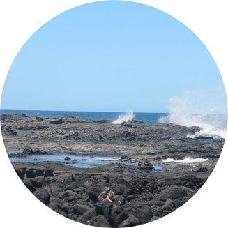
KALAEMANŌKalaemanō is a traditional place name found near the boundary of Pu'uwa'awa'a and Ka‘ūpūlehu Ahupua'a. Elder residents of the area used this name to identify the region between the branches of the 1800 Ka‘ūpūlehu lava flow where salt production was practiced. Prior to the 1800 lava flow, Kalaemanō stood on the fringes of Kahuwai, an ancient Hawaiian village located roughly 1.5 miles southwest of Kalaemanō. Oral histories indicate that during the Historic period, families who lived in the uplands made regular visits to Kalaemanō, establishing habitation sites while they fished and harvest pa'akai (salt).
|
KA‘ŪPŪLEHU
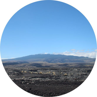
The land of Ka‘ūpūlehu, comprised of roughly 23,545 acres of land, and is one of twenty-three ahupua'a (traditional Hawaiian land divisions) that make up a portion of the North Kona region affectionately named Kekaha, short for Kekaha-wai-‘ole-o-nā-kona. Ka‘ūpūlehu is often described as one of the most favored lands in this region as it encompasses the summit of Hualālai and expands out into the ocean to include the near shore fisheries. Its size and location on the leeward slopes of Hualālai Volcano gave the native residents of Ka‘ūpūlehu access to coastal fisheries, inland agricultural areas, and forest resources.
Click here to learn how the ahupua'a of Ka‘ūpūlehu received its name. |
KEKAHA
The Kona district, situated along the leeward side of Hawai'i Island was traditionally divided into two major 'okana (land division comprised of several ahupua'a). A portion of what is known today as North Kona, was named by the native residents, Kekaha, a shortened version of Kekaha-wai-'ole-o-nā-kona, which translates to the waterless Kekaha of the Kona district. The Kekaha region extends from Keahualono, a marker situated on the boundary of the Kohala and Kona districts to the area of Kaloko-Honokōhau. The Kekaha region was known as ‘āina pele, or lands that were frequented by the volcanic deity, Pele. This rugged landscape and limited access to freshwater has influenced and shaped the life of the people prompting them to be extremely knowledgeable about their land and its resources.
|
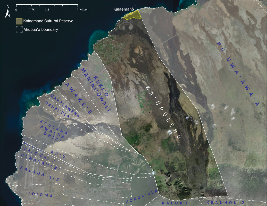
Ahupua'a within the Kekaha region

